Salary by experience
View as table
| Experience | Salary (CHF) |
|---|---|
| 0-2 yrs | CHF 80'635 |
| 3-5 yrs | CHF 85'400 |
| 6-8 yrs | CHF 92'080 |
| 9-11 yrs | CHF 100'600 |
| 12-21 yrs | CHF 105'000 |
| 21+ yrs | CHF 125'000 |
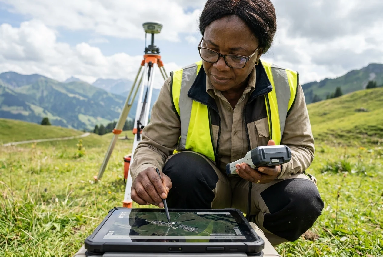
You capture and analyse geodata for sustainable planning and construction
01 · Overview
You process geoinformation, survey structures and develop geosystems for spatial planning and infrastructure.
Geoinformation is the foundation for modern planning and sustainable development. As a Geomatikingenieur/in FH, you combine technology, natural sciences and computer science. You capture precise data in the field. You analyse it on the computer. You actively shape the environment with your results. Your expertise ensures the quality of maps, land registers and infrastructure projects. You work at the intersection of surveying, software and spatial planning.
02 · Salary
| Experience | Salary (CHF) |
|---|---|
| 0-2 yrs | CHF 80'635 |
| 3-5 yrs | CHF 85'400 |
| 6-8 yrs | CHF 92'080 |
| 9-11 yrs | CHF 100'600 |
| 12-21 yrs | CHF 105'000 |
| 21+ yrs | CHF 125'000 |
| Period | Salary (CHF) |
|---|---|
| 2014-2016 | CHF 81'500 |
| 2017-2019 | CHF 88'884 |
| 2020-2022 | CHF 88'200 |
| 2023-2025 | CHF 105'625 |
| Canton | Salary | Obs. |
|---|---|---|
| Vaud | CHF 97'500 | 17 |
| Zurich | CHF 96'950 | 20 |
| Industry | Salary | Obs. |
|---|---|---|
| Utilities | CHF 125'000 | 5 |
| Information technology / Telecom | CHF 106'000 | 5 |
| Service sector in general | CHF 103'535 | 5 |
| Building trade / Real estate | CHF 90'000 | 60 |
03 · Pathway
Swiss training pathway available in the full profile
You complete a Bachelor degree in Geomatics at a University of Applied Sciences. The programme combines theory and practice.
Bachelor of Science in Geomatik
Lateral entry is often possible if you already have related initial training and professional experience.
04 · Skills & fit
05 · Daily reality
You stand in the field with a digital measuring device. You capture the exact coordinates of a construction project. Back in the office, you transfer the raw data to a geoinformation system. You check the quality of the map.
You work in surveying offices of the federal government, cantons or municipalities. You also work in engineering firms, research institutes or the private sector.
06 · Similar