Salary by experience
View as table
| Experience | Salary (CHF) |
|---|---|
| 0-2 yrs | CHF 80'635 |
| 3-5 yrs | CHF 85'400 |
| 6-8 yrs | CHF 92'080 |
| 9-11 yrs | CHF 100'600 |
| 12-21 yrs | CHF 105'000 |
| 21+ yrs | CHF 125'000 |
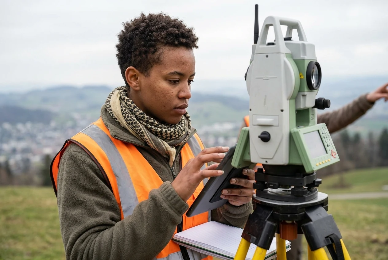
You capture and analyze spatial data for sustainable infrastructure projects
01 · Overview
Geomatikingenieur/in ETH professionals at ETHs survey the environment, develop geographic information systems, and lead complex infrastructure projects.
As a Geomatikingenieur/in ETH at an ETH, you combine engineering with modern computing and spatial planning. You capture precise geodata in the field, develop digital geographic information systems for cities, and monitor complex infrastructure projects. Your expertise ensures sustainable environmental design, aids in hazard prevention, and supports clients with clear, up-to-date data for the future. You lay the foundation for safe and efficient infrastructure.
02 · Salary
| Experience | Salary (CHF) |
|---|---|
| 0-2 yrs | CHF 80'635 |
| 3-5 yrs | CHF 85'400 |
| 6-8 yrs | CHF 92'080 |
| 9-11 yrs | CHF 100'600 |
| 12-21 yrs | CHF 105'000 |
| 21+ yrs | CHF 125'000 |
| Period | Salary (CHF) |
|---|---|
| 2014-2016 | CHF 81'500 |
| 2017-2019 | CHF 88'884 |
| 2020-2022 | CHF 88'200 |
| 2023-2025 | CHF 105'625 |
| Canton | Salary | Obs. |
|---|---|---|
| Vaud | CHF 97'500 | 17 |
| Zurich | CHF 96'950 | 20 |
| Industry | Salary | Obs. |
|---|---|---|
| Utilities | CHF 125'000 | 5 |
| Information technology / Telecom | CHF 106'000 | 5 |
| Service sector in general | CHF 103'535 | 5 |
| Building trade / Real estate | CHF 90'000 | 60 |
03 · Pathway
Swiss training pathway available in the full profile
The main path leads through a university degree at an ETH.
Bachelor in Raumbezogene Ingenieurwissenschaften / Master in Geomatik oder Raumentwicklung und Infrastruktursysteme
04 · Skills & fit
05 · Daily reality
You stand in the field with satellite-guided measuring devices and capture the exact location of structures. Back in the office, you check data quality and maintain the geodata base for ongoing projects.
You work in the office, in the field, and on construction sites. You are also active in planning offices, official surveying services, or research institutes.
06 · Similar